Lower RED RIVER RISING- (Piggy Time?)
-
Your Responses - Share & Have Fun :)
-

By Dash 1 · Posted
Made it out to clearwater Thursday morning for a little walleye fishing. Trolling both leeches and nightcrawlers. Tried several humps and depths with no luck, but the sunnies were feasting on my crawlers so when the last one nibbled I put it in spot lock and picked up a fresh meal in about 15 minutes. I guess sometimes you got to do what the fish tell you. -
By Rick G · Posted
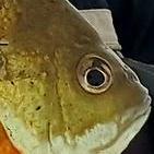
No....some kid that was fishing from shore caught it...we did take pics with it though🤣😏 -
By Eyeguyroyce54 · Posted
Yep. One fish kept us busy chasing it down river -
By smurfy · Posted
so you 2 caught 1 nice smallie.......and kept taking turns taking pictures with it!!!!!!! 😆🤣 -
-
By Eyeguyroyce54 · Posted
😄🐟 I hope all is well in fm land. -
By smurfy · Posted
tell me ABOUT IT!!!!!!!!!🥴i feed the birds at the cabin.........this is the first year in well over 20 we've had bears go after the bird feeders........hopefully some of there natural foods become available soon. -

By leech~~ · Posted
Bears are everywhere this year it seems. Just down a block from my house in Sartell. And in our campground on Edward lake. -

By monstermoose78 · Posted
Hearing green lake is on fire for crappies and plenty of eyes. The eyes are at dark or after dark trolling the deep weed lines. Lots of geese flying around. Lots of bears in the area as well. -
By monstermoose78 · Posted
Went on a fly in to Hooker Lake Ontario Canada in early June. Fishing was amazing jigs and plastics or jigs and leeches 3/8 to 1/2 oz 3-4 inch plastics. I should say the walleyes bit best off the dock with slip bobbers at dusk if you could handle the bugs. Got a photo of a bear swimming and it was coming to my side of the lake until I yelled at it. The bear knew not to mess with Monster Moose lol!
-
Recommended Posts