Jump to content
  • GUESTS

    If You  want access  to member only forums on FM, You will need to Sign-in or  Sign-Up now .

    This box will disappear once you are signed in as a member.

Recommended Posts

Posted

I'm planning a fishing trip to Vermilion this summer. It's been many years since I've been up there.

I have the Navionics + app on my mobile devices and have been marking spots that look interesting.  One of the spots I marked was a nice hump surrounded by deep water. There was a big difference between the Navionics Nautical Chart view and the Sonar Chart view. It literally disappeared on the Nautical view but showed on the Sonar View. I then ran the map "update all" and from the Sonar view now it was gone from both views with my marker out in the middle of nowhere.

So I started to look around for other areas that showed a big difference between the two views. (Many areas however do look very similar on both views) I've attached a couple of screen grabs of a spot that has a huge difference. This is on the north side of Pine Island near Matson Island.

The first is the Nautical Chart view, The second is the Sonar Chart View.

I always thought that the Sonar Chart would be the most accurate, they look more detailed, plus according to Navionics the Sonar Chart is "constantly being updated by Sonar Logs contributed by million of boaters."

I'm not really sure if I can trust either?

To anyone who knows this part of the lake, are there really the holes and humps in this area?  One view shows a 52' hole where the other has 15 FOW.


navionics.jpg

sonar.jpg

Posted

I know that part of the lake fairly well. The Sonar chart is definitely better but I'm still surprised at how inaccurate it is. There are humps etc but they don't have them in the right places.

Posted

Sonar chart is going to be more detailed (obviously). As far as accuracy it’s pretty spot on the most I’ve found navionics to be off is a foot or two usually on steep breaks or humps.

Posted

Wow, I just replicated what you show, and I can confirm the same results.  I did not expect that much of a difference.  Crazy.

  • Yayyyy 1
Posted

I also replicated the differences on my Navionics.  I don't know what to trust now.  I was in 48 FOW on Burntside last weekend and my Navionics said I was in 74 FOW, and I wasn't on a sharp break.

Posted

JL, I’ve fished burtside multiple times and have noticed that it seems to be off all over the lake. That’s the only place I’ve noticed it though.

  • Thanks 1
Posted

The sonar chart that shows 52 feet is totally wrong!

Probably more like 15' to 20' depth.

The Navionics  is probably closest to correct.

Cliff

  • Thumbs Up 1
Posted

Not seeing that when I switch it to sonarchart. I don't have navionics + app though just regular old navionics. For what it's worth I've always been on the navionics setting when I use the phone app on the lake and it's mostly spot on. Actually didn't realize sonarchart existed until now

  • Thumbs Up 1
  • Thanks 1
Posted
2 hours ago, KirtH said:

If you see any issues with mapping follow this link they are very good at fixing issues. 

http://navionics.force.com/PlugPlay?cancel=http%3A%2F%2Fnavionics.force.com%2Fkb&l=en

I actually did follow up on that same  Navionics mapping discrepancy report earlier today. I sent them the same images that I posted here.

More or less just curious to see what the response would be.

It is interesting to see that community sonar readings can be used to improve mapping software but it looks as though it's not quite perfected yet.

Posted

I have had the app for several years.  The first thing I noticed on the old app, was a series of trenches in North Niles Bay.  I skeptically went out there first thing to check it out and found nothing.  A few years later, their update corrected the issue. Found many other inaccuracies since then.   I would give the app low marks for accuracy but good marks for functionality.  It is a serviceable for scouting, navigating and marking your spots.  I do use it on ice.   I heard that Garmin did a full lake survey last year.  I am looking forward to their product.   It should be good.  

  • Thumbs Up 1
Posted

Garmin acquired Navionics last October.  That could mean some improvements in the future.

If you have the plus version of the app you can get the updates. Every few days I hit update all.

It just about always has an update to download. If Garmin just completed a survey of Vermilion maybe Navionics will become more accurate.

Posted

I have the LakeMaster chip on my Garmin GPS.  It doesn't have increments finer than 5 feet but does seem to be accurate.  Anybody else have an opinion on the LakeMaster maps?

Posted

My brother has one in his lowrwnce handheld. He’s had that for 10+ years. It seems fine. I do notice navionics is more detailed somtimes but others it’s the opposite. It does it’s job well.

  • Thanks 1
Posted
1 hour ago, JerkinLips said:

I have the LakeMaster chip on my Garmin GPS.  It doesn't have increments finer than 5 feet but does seem to be accurate.  Anybody else have an opinion on the LakeMaster maps?

I had them for years and other than the 3 foot contours thing, I found them to be pretty good.  Now using Lake insight that was bundled with my Lowrance elite units, and it looks just like the lakemaster data.  No complaints. 

  • Thanks 2
Posted

Both Lake Master and Navionics chips work fine on Vermilion.

Cliff

  • Thanks 1
Posted

Just received this email from Navionics:

Thank you for bringing your concerns to our Cartography Department.   Navionics appreciates your input.  We anticipate an update will be made available by 30 MAR 2018. I will contact you with instructions to receive the update once it has been released. Please do not hesitate to contact us if you have any questions.

Best regards,

Jennifer Pereira
Navionics Customer Service

  • Thumbs Up 2
Posted

BTW, I do have Navionics+ but I let the app expire because I preferred the Lake Master.  But I will renew my Navionics in the hope that the Garmin influence will improve their maps.  

Posted
On 3/9/2018 at 4:18 PM, mdogdaddy said:

Just received this email from Navionics:

Thank you for bringing your concerns to our Cartography Department.   Navionics appreciates your input.  We anticipate an update will be made available by 30 MAR 2018. I will contact you with instructions to receive the update once it has been released. Please do not hesitate to contact us if you have any questions.

Best regards,

Jennifer Pereira
Navionics Customer Service

Well, in less than a week Navionics followed up on the update.  I checked the Web app since it is an auto update and the new sonar view was there. Who knows maybe they improved on the rest of the lake since it was all charted last year.


Sonar2.jpg

Nautical-2.jpg

Posted

Interesting.  I had let my Navionics+ subscription expire, so I went and checked my map for the area above, and it still has the old, incorrect sonar map.  I still get application updates that show up for the app, but obviously that does not include map updates.  And when I go to the Menu and click on updates, it immediately reminds me it is expired.  So when the app is expired, it looks like it is then a static map from the day it expired, no map updates.

Posted

My Navionics app is so old that it doesn't even have an update option. It talks about having 3G and iphone 4s. I'm on version 5.0.4 with a GeoCore version of 01.00.03.

I assume that I would need to re-purchase the app to get anything useful, but I still find this old version to be helpful.

Join the conversation

You can post now and register later. If you have an account, sign in now to post with your account.
Note: Your post will require moderator approval before it will be visible.

Guest
Reply to this topic...

×   Pasted as rich text.   Restore formatting

  Only 75 emoji are allowed.

×   Your link has been automatically embedded.   Display as a link instead

×   Your previous content has been restored.   Clear editor

×   You cannot paste images directly. Upload or insert images from URL.


  • Similar Content

  • Your Responses - Share & Have Fun :)

    • LakeofthewoodsMN
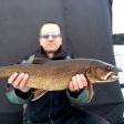
      On the South Shore...  Ice fishing remains strong across the south shore of Lake of the Woods out on Big Traverse Bay.  Resorts and outfitters on some parts of the lake have ice roads extending over 16 miles staying on nice schools of walleyes and saugers.  Many fish houses are over deep mud.  Some are on structure.  It is always fishing of course, but overall, February has been very productive for most anglers.   Extensions are being used on ice augers as the ice continues to thicken.  The thick ice this year will be good for the extended ice fishing season Lake of the Woods enjoys with fish houses out through March 31st, walleyes and saugers open through April 14th and a pike season that never closes. Most fishing activity is taking place in 26-32 feet of water.  Anglers are finding a healthy mix of walleyes and saugers, with a good number of jumbo perch in the mix this year.  Some big eelpout are also showing up.  Anglers are reporting plenty of fish for fresh fish frys and usually extra fish to bring home.   The one-two punch of a jigging line and deadstick is the way to go.  On the jigging line, jigging spoons with rattles tipped with a minnow head have been consistent.  Lipless crankbaits and jigging rap style lures also doing well.     Lures with a light have been working well in the stained water.  Please remember, in MN, lures with a light or water activated light can be used as long as the battery is mercury free and the hook is attached directly to the lure and not as a dropper line.     On the deadstick, a plain hook or a small jig with a live minnow 6 inches to a foot off of the bottom.    Some days, mornings are better, other days, it's the afternoons.  There is no distinct pattern, they could come through at any time. On the Rainy River...  The start of the day and end of the day have been best for those targeting walleyes on the river. A jig and minnow or a jigging spoon tipped with a minnow head is also producing some fish. Some big sturgeon being iced by ice anglers targeting them.  It is a catch-and-release sturgeon season currently.   Although ice conditions on the river are good, they can vary significantly due to the current, so anglers should always consult local resorts or outfitters for the most up-to-date safety information and fishing advice. Up at the NW Angle...  Ice fishing has been strong in the islands area of Lake of the Woods. Resorts continue to move their fish houses around, staying on the best schools of walleyes.     Anglers are catching a nice mix of walleyes, saugers, and jumbo perch with an occasional pike or tullibee as well.     Big crappies are still being caught just over the border.  Fish houses are available, check with a NW Angle resort for info on crappie fishing.   Lake of the Woods enjoys an extended ice fishing season with fish houses on the ice through March 31st and walleye and sauger seasons open through April 14th. Perch, crappie, and pike seasons remain open year-round.    
    • leech~~
      Maybe you should put rattle wheels down, if your going to sleep for 6hrs! 🤭 😆
    • JerkinLips
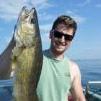
      Monday was my worst day of winter fishing on Vermilion in the last 4 years.  Caught only one 14" walleye in nearly 8 hours of fishing.  Missed two other bites and was marking very few fish.  Maybe the fish were taking Monday off after a big weekend.   No more water came up on the ice under my house.  Think it was because I haven't banked snow around it for a couple of weeks so the bare ice around the house is getting very thick.  I measured 38" of ice under my house and the Ion barely made it through even with the extension installed.  Needless to say I banked around the house this time.  Another lesson I learned today is don't drill holes if ice is frozen on your blades.  I did that on one hole and it didn't center properly and drilled at an angle on the edge of the opening.  Hope I can correct the location and angle on my next trip up.   Not much change in the surface lake surface conditions.  The drifts may be a little higher and are definitely harder.  There are still a few bare ice spots on the lake.  Very little activity on the lake today.  There are about 3 dozen houses from McKinley Park out to Birch Island.  Another person pulled there house off today, and I am sure many more will pull theirs off this coming weekend.  Only 13 days left of walleye season.    
    • leech~~
      A good start for never picking up a bow!   IMG_1910.mp4
    • leech~~
      Um, #metoo   leech~~ Author 'we have more fun' FishingMN Builders Posted January 26 My whole goal for the rest of this season.  Is to watch KC lose and Taylor cry!  🥳
    • smurfy
    • Wanderer
      Smurfy is happy.
    • Dash 1
      Great looking food. So far not much of a game and I thought the halftime show was worse I've seen. 
    • leech~~
      Oh is there a Superbowl game? 😋😋
    • Kettle
×
×
  • Create New...

Important Information

By using this site, you agree to our Terms of Use and Privacy Policy. We have placed cookies on your device to help make this website better. You can adjust your cookie settings, otherwise we'll assume you're okay to continue.