-
Your Responses - Share & Have Fun :)
-

By leech~~ · Posted
Not many old hockey players here it looks like? Probably all video game players! 🤭 -
By leech~~ · Posted
My hockey stick in high school, today's hockey sticks! But hey, don't worry mom and dad, you can make payments! 🤣 $359.99 CCM JETSPEED FT7 PRO GRIP COMPOSITE or monthly payments as low as 31.65. ccm-jetspeed-ft7-pro-grip-composite-hockey-stick-senior.webp -

By smurfy · Posted
gonna try chasing them too!!!!!!!👍 i gotta list of lakes i wanna hit next week.......just not sure what order yet!!!!!!!!!!🙄 decisions.......decisions!!!!!!!🥴 -
By Kettle · Posted
The water Temps on most lakes are low 60s. Crappies in the shallows on just about every lake. Best time of year -
By smurfy · Posted
what lake!!!!!🤪🤗 i'm headed up tomorrow afternoon till sometime memorial weekend....... mabe head back home sat or sunday to avoid traffic!!!1 -
-

-

By Wanderer · Posted
Might not have to wear ear plugs when I mow! That’s a spendy one. It wasn’t hard to find one of those for $6k. Comparatively and Ariens of the same size is $4,200. A home owner grade JD for $3,900. You could get into a commercial grade Z700 for maybe $8k. I think the work I did today with mine would’ve killed that one there. -

-
.thumb.jpg.5c1a86e9339e49e53f5bfefed2220054.jpg)
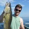
By LakeofthewoodsMN · Posted
On the south end... This year's MN Fishing Opener weekend was not only great weather wise, the walleyes and saugers were caught in good numbers. A main fish gut hauler working with a number of resorts commented it was one of the most productive opening weekends he has seen based on the amount of fish guts collected after the weekend. The goto presentation was a jig and frozen emerald shiner. Emerald shiners are a staple in LOW and walleyes love them. Other minnows worked also, but emerald shiners are a favorite of anglers for good reason. Four Mile Bay held good walleyes in 12 - 18'. Not a surprise as the walleye bite on the river during the spring season was good and as of late, sturgeon anglers have been reporting catching walleyes on sturgeon rigs. The Lighthouse Gap area, Morris Point Gap and just in front of Pine Island held nice fish in 12 - 15'. Across the south shore, 18 - 22' was holding good numbers as well. As you can see, there are lots of fish around. A quarter ounce jig in gold, glow white, pink, orange, chartreuse, or a combo of these colors tipped with a minnow worked well. As a reminder, the limit of walleyes and saugers is a combined limit of six fish, up to four of the six can be walleyes. All walleyes between 19.5 - 28.0 inches must be released. One fish over 28.0 inches can be kept. The possession limit in MN is one daily limit of fish. On the Rainy River... Some nice walleyes were caught on the river this weekend, although most anglers hit the lake. 10 - 15' of water was the norm. Sturgeon fishing on the Rainy River has been excellent. The catch and release season continues through May 15th and then closes until the keep season starts up again July 1st. Up at the NW Angle... Some nice walleyes were caught in 18 - 25 feet of water, a little deeper than anticipated. Points were good as were areas with structure. The morning and evening bite was best. As water continues to warm, go to spots for walleyes will be neck down areas, shoreline breaks, points and bays. The goto presentation was a jig and minnow.
-
Recommended Posts