Jump to content
  • GUESTS

    If You  want access  to member only forums on FM, You will need to Sign-in or  Sign-Up now .

    This box will disappear once you are signed in as a member.

The Mississippi north of Elk River


Recommended Posts

I grew up living close to the Miss in Champlin and know the stretch pretty well from the Coon Dam north to the Crow River but from there I am lost. Can anybody let me know where I can find a good map of contour depths and other things for the Miss from the Coon Dam north. I can find them for everywhere south of the dam. Even some info from you guys would be helpful and greatly appreciated. I would like to go north more and do some smallie fishing but don't know where a decent area is to start.

Link to comment
Share on other sites

go to the DNR website and find the link to the fisheries offices around the state. click on the montrose office. once you get there they have a whole section on the river from st cloud to dayton(where the crow meets the mississippi). there is also links there to studies the office did on the river in this section. they also have general depth maps made and posted on the site as part of the one study(depth was compiled when the water flow was only 5000CFS(normal conditions) the depth will be alittle off because of all the high water and flow rates. if you can't find what I am talking about email me at the address in my signature line and I will reply with a message and attach the maps and studies(they are in PDF form and I saved them). by the way I am from monticello and fish the river from clearwater to elk river at a lot of various shore spots along this section. one other thing once you start getting up in this section of the river there is a lot of rocks and other hidden dangers under the surface. it is not advised to take a prop drive boat in this area. if you do it would be at your own risk of wrecking your prop or whole lower unit. this is the reason I shore fish this section until I can get a flat bottom boat with a jet driver outboard on it. I have a boat now but it is a prop drive and I will not risk it in the river in this section.

feel free to email me with other questions

Brad B

Link to comment
Share on other sites

also forgot start around monticello for smallies especially during the fall & winter time catch and release season. second choices would be to try by becker or otsego. email me and I can give you alittle more detailed info that I don't feel like posting here.

Link to comment
Share on other sites

With the high water level we still have would it even be possible to get around in a boat around Otsego to Monticello. I can't afford to go buy another boat just to fish this part of the river. I do have a small jon boat for a second boat but it's only an old 8 footer so putting a jet motor on it is out maybe a small mud motor could work but not sure of how big a motor the boat can handle since the smallest mud motor I can find is a six horse.

Link to comment
Share on other sites

even with the high water I still personally wouldn't take a prop motor out there. there is too much stuff under the surface that will take out your prop or lower unit. also remember with the high water the flow rate is faster then normal so if you have the motor go down you would be in some serious trouble. If you still want to try then I suggest you launch and head up river so if the motor get damaged you can float back to where you launched from. also stay close to the shore and watch you fish finder as the depth can change fast. If you ever do get a chance to get a different boat you should consider getting a prop tunnel hull boat. it lets you run a regular prop motor but it sets it higher up on the transome and the prop is in line with the tunnel on the bottom of the boat. this design allows for you to go in shallow water but still would be good on a lake. the negative of a jet outboard is they shouldn't be used in lakes with alot of weeds. weeds getting into the intake would plug it and wreck it. you might also want to post the same question over in the mississippi north forum. more people will read it there instead of here.

Link to comment
Share on other sites

  • 8 months later...

There's not aways a "channel" so to speak in the boulder fields. Go slow when you're approaching the shallows as it will take a while to get up stream and when you do hit (and you will hit something) hopefully you're going slow so the damage is minimal.

I've had to replace my lower unit twice now from boulders on da Sippi from Dayton to Monti as I thought I knew my way and WHAP. It's the worst feeling knowing you just spent $500 in a split second to replace the lower unit, ah twice. (25H Merc)

Best way to know the river is to get out there and create your own experiences or have someone that knows take ya.

Also, be carefull going downstream to not get hung up on a boulder. That too happened to me alone. So as I approached the boulder field the current speeds up and I pick my path. Only to put myself on the top of a boulder. Now the current moves my boat to a 90 degrees as I'm teetering back and fourth. I thought that was the end of me as the boat gunnel wall was a mere inch from taking a Sippi bath and me for a ride. I'm at the front of the boat trying to put more weight in front to lift it off, but that didn't work. Then took out the push pole but that's not working either. Eventually the river kicked me off the rock and I was on my way to the ramp safe again. Whew!

Any ways - sorry, don't mean to scare you off. Just take your time until you know that stretch and you'll be fine.

Link to comment
Share on other sites

  • 4 months later...

I live on the Mississippi just north of elk river. Invest in one of these www.rockhoppermotorguard.com/ works well. I have hit stuff at 20MPH motor kicks up and it saves the lower unit. You still have to go slow in spots but it saves your prop. I have a shoot thru hull transducer and at 1.6 to 1.8 ft i start nicking the bottom with the skeg.

Link to comment
Share on other sites

My first "fish the river boat" was an 8 foot jon, get yerself a pair of oars, scoots that little jon around like a champ.

Link to comment
Share on other sites

  • 2 weeks later...

Boats are nice....I still fish out of a dented-up amazingly crappy jon boat when I wanna motor around the river. A 9.9 Johnson gets me where I gotta go most of the time, but I'll wade the boat through shallow spots when necessary.

For my money, which isn't much, I prefer either a canoe or just plain wading. You can cover a lot of water with a crappy pair of tennis shoes, and you'll find spots that you normally wouldn't fish if you were "zipping by" (if that's what you do when going upstream in a 9.9 Johnson). The best way to find a small drop off is to step off of one! smile

Link to comment
Share on other sites

Quote:
The best way to find a small drop off is to step off of one!

Ha - that can be scary when you can't see the bottom, but you'll find em that way.

Link to comment
Share on other sites

Yup. I've done my share of it. In my slightly younger and more unintelligent days, I used to do lots of wading in the late fall. Stepped off a rock once well over the waders and scared the carp out of myself. Now, after August, I stay a bit shallower.

Link to comment
Share on other sites

  • 5 months later...

I been looking for a depth map for the Mississippi between sartell and st cloud.I've spent a lot of time looking at Dnr ,google images,and such.Is there even such a thing like this?mainly I'm looking for sartell Mississippi.

Link to comment
Share on other sites

There might be a map, but it probably wouldn't be all that helpful because water levels fluctuate quite a bit between the Sartell and St Cloud dams.

If you're looking for deep spots, you don't need a map...a bit of time on the water, and you'll be able to spot the deep(er) spots no problem. Just look for slower water (for the deeper spots) and the sound of your prop bouncing off the rocks (for the shallower ones).

The stretch under and just south of the Hwy 15 bridge is really shallow, and there are a few more areas north of there that are also--one a hundred or so yards north of the Hwy 15 bridge, one just south of the Sartell bridge, and one in between them. In low water, they're only a foot or two deep. They're easy to spot--just look for the riffly fast water.

Link to comment
Share on other sites

Thanks carmike. I will look for slow water more and check the depths.I know a few slow spots below sartell dam to check.

Link to comment
Share on other sites

Jeremy there is no map for that section of river, trust me, I have looked everywhere. I fish this section atleast one or two days a week July-Sep. it's a learn as you go type section of the river wink

Link to comment
Share on other sites

Thanks Rick,I have covered some places on that part of the river but I have a lot more to explore.I really like how some fisherman keep a log book or app for fishing.I might try that for the river.It seems like its more of a lake thing than river.The river changes so much its hard to say a structure will be the same the following yr on the river.

Link to comment
Share on other sites

The river changes so much its hard to say a structure will be the same the following yr on the river.

After you get south of the Sauk Rapids bridge it fishes more like a lake than a river for a good part of the summer. The only structure that moves are sand bars and log jams, sure the shorelines get a little more eroded each year but it takes a while for anything to change in a major way. The holes have been holes as long as I have been fishing there, and the rocks always seem to be in the same places too.

North of Sauk Rapids all the way up to the dam is pretty shallow with a few nice holes, this section is more of a river, always moving and always changing. I have launched at the SR muni park and headed up to the dam a few times and it's always an adventure.

Link to comment
Share on other sites

Here is a link for you Jeremy, as Carmike alludes ..... you cant use it to not wreck your lower unit, but should give a decent idea of what to expect...... River Depth Map From St Cloud To Coon Rapids

ooops! guess i need to read better...all that money wasted on a college education grin Well, if you want to fish below the dam....here you go.....

Link to comment
Share on other sites

ok push button,I downloaded those PDF files I guess there too tbig For a smartphone il have to download those maps on my lap

Link to comment
Share on other sites

I originally posted about all this for spring/summer.just wanna be clear its not for ice fishing or winter.

Link to comment
Share on other sites

Jeremy, you should check out our Mississippi river North forum, there are more people lurking around in there than there in in this forum.

Link to comment
Share on other sites

Join the conversation

You can post now and register later. If you have an account, sign in now to post with your account.
Note: Your post will require moderator approval before it will be visible.

Guest
Reply to this topic...

×   Pasted as rich text.   Restore formatting

  Only 75 emoji are allowed.

×   Your link has been automatically embedded.   Display as a link instead

×   Your previous content has been restored.   Clear editor

×   You cannot paste images directly. Upload or insert images from URL.


  • Your Responses - Share & Have Fun :)

    • leech~~
      That's a good first step. But are you ready to buy this for the ranch and save the plant more? 🤭   EGO POWER+ 56V Battery 52" Zero Turn Lawn Mower. PRICE $8,899.00 534842_main.webp
    • gimruis
      I got a nice Tom in season B and posted photos in the local thread (Moose's report).
    • Wanderer
      Did you have any luck?     I got a bird but didn’t really do much for pics worth showing.
    • Wanderer
      It depends on a lot of factors, I suppose.   I hung on to my last gas auger for a few years after getting into electric but I never used it so I finally sold it.  Haven’t missed it one bit.  You bet it was reliable though.  Still started on the second pull for the new owner.   After trying several options in the electric world, I’m currently settled on a Strikemaster 40V with Liteflight bits.  With 2 fully charged batteries, I fish all day in Canada, cutting 10 inch holes.     What I’ll agree with is, if you search by drilling and flasher sonar, you will probably be more comfortable with the run time of a gas auger.  When you start incorporating GPS mapping, forward facing sonar, and saved waypoints, you don’t need to Swiss cheese every spot you fish.  I can still run through both batteries when the fishing isn’t great but I never feel like I have to count my holes.  It’s more like: Did I need the second battery before the middle part of our fishing hours?  If I still can’t catch fish after running out 2 batteries, it doesn’t matter cuz the fish just ain’t biting.   That’s fishing on the dark side! 😉 
    • Wanderer
      Thanks.  Yep, iPhone. Photo mode, not portrait. No flash.
    • leech~~
      I didn't pick Leech~~ for no reason!  
    • leech~~
      Do you have an iPhone?   Great shots.  👍
    • Rick G
      Yep, that's where I was🤪. Best fish were way up in the shallow boulders...   And.....if the 3 or 4 people that read this want to fish it.... go right ahead😁😏  My bass spots are no secret....trophy panfish spots, that's another story🤪
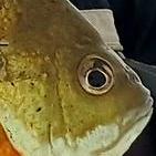
    • Kettle
      Fish are still very shallow with water Temps near 60. Two guys tonight 19 total kept 10  
    • Wanderer
      At home.  It was spectacular for a while.
×
×
  • Create New...

Important Information

By using this site, you agree to our Terms of Use and Privacy Policy. We have placed cookies on your device to help make this website better. You can adjust your cookie settings, otherwise we'll assume you're okay to continue.