- 0

-
Your Responses - Share & Have Fun :)
-

-

By leech~~ · Posted
Where do you buy your birds? I'm all for free range and such but are you still plucking um as you chase um? 😜 -
By leech~~ · Posted
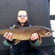
Like Muskys and casting, Lake trout can be the fish of 10,000 Jigs! 🤪 🤣 -
By JerkinLips · Posted
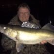
Currently just to my Facebook family and friends. I could start a topic on this fishing forum but it could be quite boring. Didn't catch a laker on 3 trips to Burntside last winter. Did have good fishing on Vermilion-Trout in the BWCA in early January but that can be very difficult travel. -
-
By smurfy · Posted
Wow that's alot of ice! -

By monstermoose78 · Posted
Went to Mille Lacs with my dad and ended up with 17 perch and one tullipee. That was on Sunday we fished hard and I burned through 3 9 amp batteries I would say about 25 holes per battery through 32-36 inches of ice. -
By mbeyer · Posted
i'd like to read about your lake trout trips....do you post them somewhere? -
-
-
Question
busse3775
Are there any types of software programs that will enable you to save waypoints and such on the computer? I have looked at the Navionics Webapp some but I wasn't able to save a waypoint, or at least I wasn't able to figure it out.
5 answers to this question
Recommended Posts
Join the conversation
You can post now and register later. If you have an account, sign in now to post with your account.
Note: Your post will require moderator approval before it will be visible.