- 0
-
Your Responses - Share & Have Fun :)
-
By JerkinLips · Posted
My 3rd guess was finally correct. Definitely a moving target this year. Guess Date Ice Out 2/28 3/27 3/12 4/7 4/9 4/13 -

By Kettle · Posted
I have a few days off so hopefully fish 4 days in a row from sunrise to sunset. Likely two or three lakes a day depending on the bite. I won't fish any well known opener lakes until the weekday. -

By smurfy · Posted
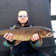
i'm into them slimers.........dem make good picklin and smoker material......i'll chase some crappies too!!!!!! -

By leech~~ · Posted
I usually only catch small slimers on opener until first part of June before the eyes really start, on my lake there. -
By smurfy · Posted
yes sir!!!!!!!!! by then most the riff raff is at home!!!!!! -
-
By smurfy · Posted
is 3 weeks away............who's going and where???? i skip the first week and i'll head up to the cabin the 2nd week. ussually fish smaller lakes. -
-
-

By SkunkedAgain · Posted
I might have missed a guess, but here are the ones that I noted: JerkinLips – March 27th, then April 7th Brianf. – March 28th Bobberwatcher – April…. MikeG3Boat – April 10th SkunkedAgain – early April, then April 21st Definitely a tough year for guesses, as it seemed to be a no-brainer early ice out. Then it got cold and snowed again.
-
Question
Guest
If anyone has the Magellan MapSend topo CD for Magellan GPS's, I understand through reading descriptions of the product that it has topo of all land features, but does it also have topo for lakes?(ie. humps on the lake floor, or sudden drop offs) I want to buy the product but only if it shows features under the surface of the water.
Thanks
Kurt
[email protected]
Link to comment
Share on other sites
2 answers to this question
Recommended Posts