Jump to content
  • GUESTS

    If You  want access  to member only forums on FM, You will need to Sign-in or  Sign-Up now .

    This box will disappear once you are signed in as a member.

new tool for hunting in MN


Scoot

Recommended Posts

IslandLaker,

Only the Garmins which end in an X take an SD/microSd for Garmins so for instance the Summit HCx would. I do have a Mapsource plug-in that allows my maps to be included with MapSource allowing you to send my maps to the GPS units main memory. If your GPS came with a MapSource program like Trips and Waypoints or City Navigator, then you could use the MNTRAX - Garmin MapSource program. Just an FYI, in case yours is the HCx, look under the batteries as this is where the card slot is on many of the units.

For ND, 24MB would be fine which is the memory available on the Summit, but for MN for now, it isn't enough memory. I am planning on putting out one more update for MN. It will not change the land elements, but it will decrease the memory the map takes, and at that point, 24MB could be enough if you want to upload the land elements during hunting and the lake elements during fishing season. Watch the K outdoor products web site and when it says MNTRAX 2.6 releases, then it would probably be fine.

Link to comment
Share on other sites

  • Replies 101
  • Created
  • Last Reply

Top Posters In This Topic

  • Kirsch

    25

  • Scoot

    12

  • Realtor Boy

    5

  • RBuker

    4

I just ordered the mntrax last night and was just wondering about average how long it takes to come?

I also would like to see the tax forfit land stay on the program.

Link to comment
Share on other sites

Scoot:

Can you check and see if that will work on IP man's gps for MN?

I am interested.

WG

Link to comment
Share on other sites

Shunker_Lure: The order came through today and was processed and shipped today as well. It went out USPS First Class from Fargo, so I would expect you have it by Thursday most likely.

Per your comments, tax forfeit is on the map currently and hopefully if the feedback on it continues to be good will stay.

WalleyeGod: if you let me know the make and model number I can tell you if it will work. Thanks. As a rule if it is a Garmin or Lowrance (with the exception of the Endura) which accepts a memory card, it is fine.

Link to comment
Share on other sites

RogRod,

As long as your Astro accepts a memory card (which I believe they all do), it will work fine. I have many customers using them. Pretty neat to see a dog working on your GPS unit for instance in ND and see how close they are getting to the edge of a PLOTS field or in MN seeing how close the dog is getting to the edge of a WPA, WMA or even a tax forfeit property.

Link to comment
Share on other sites

60CSx, yes as it has a memory card slot, 60C, maybe. For units that don't have a memory card slot, I do provide a purchasing option called MNTRAX - Garmin Mapsource.

It is compatible but the issue is storage for map data. The 60C has 24MB of internal memory. This would be enough for most of NDTRAX but it a stretch for MNTRAX. I plan to run through a map optimizing process this week to try and trim a bit of size from the overall map as additions such as tax forfeit land has dramatically increased the dataset size. After this is complete, I will let you know if 24MB may be enough. The entire map will not fit not matter what I do to it but you may be able by using the MNTRAX - MapSource program to load land elements in the fall for hunting and lake elements in the spring, summer and winter for fishing. I will keep you posted on final sizes when this optimization process is complete.

Link to comment
Share on other sites

They are available right here on FishingMinnesota and also at Reeds currently. Gander Mountain will hopefully be picking it up very soon as well. One of the great advantages of ordering through FishingMinnesota.com is they take the order, and I fill it, so you will always get the latest version and even with mail, it usually only takes a few days.

Link to comment
Share on other sites

Does the reeds in walker have the updated version with the tax forfieted land?

Link to comment
Share on other sites

The version at Reeds does not include the tax forfeit land at this time but after purchasing it, you could send it to Kirsch's Outdoor Products at 7915 Aquarius Drive Fargo, ND 58104 and you would get a free update shipped right back to you at no additional cost.

I will be contacting Reeds in the next week and seeing how many MNTRAX they have left and updating their stock with the update but for now, it is the version before the tax updates were released.

Link to comment
Share on other sites

Got my update back. Thanks.

Is there a way to upload the info (especially the tax forfit land) to my Google Earth? I'm impressed how much der is up-nort! Just browsing on my little XOG screen is hard to do. Would prefer to look at it on my computer.....

Thanks.

Chad

Great question!

Link to comment
Share on other sites

At this time no. Ironically for about 6 years, I produced a product called LakeTrax Pro. It was an incredibly technical GPS/PC solution allowing the user to see the maps on the computer, print maps, interface directly with the GPS in field or at home and at the time all people wanted were the plug and play cards and I quit producing this solution smile Now I have the plug-n-play cards and what people ask for is something similar to my old system. I totally understand what you are saying and it is a great suggestion.

The answer currently is not at this time, but I am always looking for ways to do this that can be easy for sportsman to use. Keep watching the website and Fishing Minnesota, as there is a strong possibilty there may be an add-on available next year to allow some of the things you are mentioning. No promises, but I plan to start working on it early next year. Thanks for the suggestion.

Link to comment
Share on other sites

Korey,

I havent been able to find this feature but its a shot in the dark. Does this card show the contours of the land? Ive been using the card a lot lately and I have been bringing out a printed copy of where Im going from google earth, just to help me with some funnel areas I have been trying..

Link to comment
Share on other sites

Realtor,

No MNTRAX does not include elevation contours. There is so much detail on MNTRAX, adding topo lines crisscrossing over everthing makes the map very difficult to read. At this time the majority of sportsman have indicated to me there are lots of topo solutions out there but MNTRAX is the only map that gathers the rest together. If I hear this request more and more, it is a feature I would consider adding.

Link to comment
Share on other sites

Does anyone know what what models of "dashboard" GPS units this will work in? Would prefer to use it in one of those rather than my handheld for finding public land up north.

Link to comment
Share on other sites

Mine showed up on monday, I put it in my lowrance 332 wich is mounted on my dashboard, looks like a very helpful tool!

Link to comment
Share on other sites

CastMaster,

This will work in virtually any Garmin or Lowrance GPS unit. If you will never take it off your dash then I highly recommend a Garmin Nuvi. You can buy them from $100 on HSO-Classifieds to as high as $500+. Go to a local sporting good store and play with them all and find one you like. DO NOT buy a 200 or a 650. Any of the Nuvis in between or higher than these numbers are fine. I have a special build of my map for these two GPS units but I still recommend others.

If you wish to pop it off the dash and take it into the field or in the boat, then you want a waterproof one and the only Nuvi which is waterproof is the Nuvi 500 (and 550 but that one is hard to find). Very nice GPS and it can be used virtually anywhere. It even has topo of the entire US on it. The TRAX series will work with any of Nuvi GPS units.

Link to comment
Share on other sites

  • 2 weeks later...

Been reading up on the MNTRAX product and it sounds great. I do have a few questions. I have both the older etrex legend (no chip) and the new colored etrex legend hcx (microSD) and use mapsource software with both. Would the disc/software version of MNTRAX also work with both of these units? If I went with the microSD card and only used it with the legend hcx, do my waypoints/routes save to the microSD card or internal memory on the unit? Could I plug the unit into my computer and be able to see the lake contours when I opened up mapsource? I like using mapsource to mark out spots/routes first and just transferring to the unit. Does the $20 upgrade charge also apply to the disk/software? Thanks.

Link to comment
Share on other sites

Gators6, I have answered your questions below.

Can the MapSource version be used for both GPS? It is designed to be used with one GPS but it can be used with two. However, the issue is the Garmin Legend only has 8 MB of memory and to load all of MNTRAX, it would take 48MB. The nice thing is you can choose different layers but the layers which hold the contours or even just the hunting land would take more than 8MB of memory. With 24MB, I would say probably, but not with 8MB.

If I went with the microSD card and only used it with the legend hcx, do my waypoints/routes save to the microSD card or internal memory on the unit? All Garmins I have used by default store waypoints to internal memory, so inserting MNTRAX will have no impact as all the saved waypoints are still there.

Could I plug the unit into my computer and be able to see the lake contours when I opened up mapsource? This will not work with either MapSource or the MNTRAX - Garmin version. The MNTRAX - Garmin Mapsource integration is designed to be a transfer process only. The map which shows up in MapSource is an overview map and you will not see the tight details such as lake contours. It is something being looked at as a possible add-in for the future to have some type of PC integration but not at this time.

Does the $20 upgrade charge also apply to the disk/software? Yes, it does for the MapSource version as well as the memory card (Garmin or Lowrance) version.

Thank you for the questions and I hope you had a Merry Christmas.

Link to comment
Share on other sites

Korey,

What are the possibilities of getting the snowmobile trails plotted on your maps?

Cool Product

Steve

Link to comment
Share on other sites

Steve: It makes perfect sense to include snowmobile trails on an outdoors GPS map. In speaking with the Minnesota DNR, they convinced me including snowmobiles trails on my GPS maps would be too great of a risk. The MN DNR end up getting involved in potential law suites every year even with very generic paper maps. A few people hit a tree with their sleds and say they were following your map and you are involved in a law suite even if the maps state not for navigational purposes. The other reason is that the trails can change so easily as they groom a new trail due to a variety of conditions. I do include hiking and hunting trails as they tend to stay more static.

Thank you for the suggestion and it is always a possibility in the future if the DNR or other sources end up with more frequently updated data.

Link to comment
Share on other sites

Thanks for the response. I understand the liability issue. I saw somewhere that someone had a GPS chip or download of the MN snowmobile trails.

Happy New Year comming up

Steve

Link to comment
Share on other sites

Thanks for the info Kirsch! One more question... is the MN lake list updated on your site? I didn't see Vermillion, Mille Lacs or Upper Red Lake.

Link to comment
Share on other sites

Will this work with a Gamrin nuvi 255w. It has a microSD card, but i'm wondering if the unit has enough memory and cant find it anywhere?

Also, if it does, do i just insert the card into the GPS and all the data is there for use or do i need to tranfers from the computer to the GPS?

Thanks

Link to comment
Share on other sites

Guest
This topic is now closed to further replies.


  • Your Responses - Share & Have Fun :)

    • leech~~
      Yeah was just being a smartAzz about cranes being the only "waterfowl" you eat with salt and pepper.  😏
    • Kettle
      We feild hunt for them, lot of time it's figuring out their route from water to feilds and pass shooting as they don't fly high off the ground. No turkey where we go. Do normally see a moose or two. Have had coyotes come in and try and steal decoys tho
    • SkunkedAgain
      Actually, I think that I know what you are talking about. There is a large tree in there. After visiting with the neighbors a few years ago, I headed back in my boat. The boat actually rode up on top of the tree and got stuck. It was 11pm and late fall. I tried rocking the boat, shifting between forward and reverse, but couldn't get it off. After about 10 minutes I decide to swim to shore with a rope, tug it off of the tree, and then go warm up. As I went to the back of the boat again, but this time to strip down for the swim, the boat just slid off of the tree and back into the water.
    • leech~~
      When you set up your deks for crane in the pond, do you ever get Turkeys landing in the set?  
    • Kettle
    • Kettle
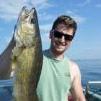
      I'd take a beef ribeye or beef tenderloin over crane any day. It's similar to venison and the only waterfowl i eat with just salt and pepper. When cleaning them it smells more like a pheasant than a duck or goose, not nearly as pungent. Just so fun to watch em fly, they are prehistoric looking. Fished tonight with a retired buddy and sent him home with 6, water Temps around 67 degrees. Jig and minnow. Hard to leave to go waterfowl hunting with the walleye biting 
    • Dash 1
      Fished Osakis early yesterday morning.  Temps were 67-68. Found walleye in 12-21 ft along with small perch. Kept a 16 and 18 for supper. Almost too warm to fish. What a crazy September. I was using nightcrawlers with a spinner rig. Got the 18 on a 2 inch crawler after perch bit it off twice and I was too stubborn to replace it. 
    • Troy Smutka
      Has been a warm, but fun start to the 24 waterfowl season. Got out for the first two days of the early teal and early goose season. Got my son out both days of the Youth Hunt, and got out both days of opening weekend. Mostly singles and doubles coming in so far, so my son Parker has harvested most of our birds. Not great numbers, but good variety for a very warm September in central MN. We have harvested bluewing teal, greenwing teal, shovelers, mallards, wigeon, pintails, a nice drake ruddy duck, and geese. Water levels are much higher than last year, with one of the lakes we hunt being about two feet deeper than last season. Hopefully some cooler, more seasonable temps will settle in and start bringing the calendar migrators through the state. Good luck, and I will see you out there somewhere.
    • smurfy
      Yea iffin Kettle says that's what it's like I'd tend to believe him, he has harvested a few 👍   Besides everyone knows  guys that hunt and fish never fib 🤗😉
    • Mike89
×
×
  • Create New...

Important Information

By using this site, you agree to our Terms of Use and Privacy Policy. We have placed cookies on your device to help make this website better. You can adjust your cookie settings, otherwise we'll assume you're okay to continue.