All-In-One ice fishing Humminbird GPS dephtfinderfor GPS mapping, depthfinder, & graph maximizes time, puts fish on the ice.
by Jim Edlund

Via the Quick Connect bracket, the Humminbird 597ci HD trifecta—GPS, sonar and graph—is moved back and forth from ATV, snowmobile, or truck to Ice Pack—with ease.
These days, the owner/operator of Perch Eyes Guide Service says he takes to hardwater with “war-like strategy,” employing the latest in ice fishing electronics to help him quickly locate and stay on top of fish throughout the winter.
Although he says there are a number of manufacturers making good flasher units these days, for him it comes down to the all-in-one—a piece of technology that not only features a flasher, but a graph and accurate, onboard GPS mapping. For ice fishing Humminbird GPS dephtfinder.
“Without a doubt, the all-in-one unit makes the most sense to me,” says Feldner. “I simply don’t have time to mess around with carrying numerous units to do separately what I can do with just one piece of electronics.”
For Feldner, there’s no more significant feature than the onboard digital GPS mapping power that ice fishing Humminbird GPS dephtfinder units offer when combined with LakeMaster cards.

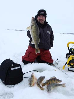
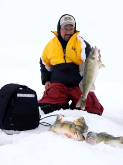
The all-in-one GPS, sonar flasher and graph of the Humminbird 597ci HD help Jason Feldner find—and stay on—quality fish like these.
Using a Humminbird 597ci with onboard GPS and easy Quick Connect bracket, Feldner swaps the unit back and forth between his vehicle, ATV or snowmobile and Ice Pack for hole-hopping. When ice fishing use the Humminbird GPS dephtfinder.
“During early ice I use the 597ci on my ATV. I’ll cruise an area—just like I would during open water with the boat—and when I find a flat or a piece of structure that I want to work, I’ll start zigzagging across the one-foot map contour lines, leaving tracks over areas I want to fish. Then I’ll go back along the tracks and drill my holes,” Feldner says.
Then he’ll simply remove the ice fishing Humminbird GPS dephtfinder unit via the Quick Connect bracket and throw it into the Quick Connect bracket in the portable Ice Pack and go back and fish the areas. “It’s really that simple,” says Feldner.
Inevitably, once Feldner starts icing fish he’ll punch in a waypoint and look closer to determine what contour line is holding the fish.
“This is the reason we use LakeMaster cards: one-foot contours. Nobody can compare to that. Plus, with the Depth Highlight feature, I set that specific depth where fish are at to green for ‘go’ and everything else to red for ‘stop.’ Now, with a quick glance at the screen I have a target area to explore, eliminating a lot of junk water with the press of one button,” says Feldner. “And at that point staying in the zone is easy.”
Once he identifies that magic contour or depth, Feldner pops the ice fishing Humminbird GPS dephtfinder unit out of the Ice Pack, puts it back on the ATV and then drives down that specific contour line for a quarter mile or so, drilling a new line of holes. When finished, he’ll pull the unit off the ATV, put it back in the Ice Pack and start hole jumping again.
“Clients are simply blown away with the rapid-fire system we use for locating and staying on fish,” says Feldner. “It’s like war. We’re constantly moving in relation to the fish to position ourselves at an advantage.”
And the beauty of the system is that it doesn’t matter what you’re fishing – walleyes, crappies, pike, ‘gills, or perch – the same concept holds true.
“The all-in-one ice fishing Humminbird GPS dephtfinder unit has changed how quickly we can find and stay on fish,” says Feldner. “Whether it’s on my snowmobile, ATV or truck in mid-winter, the Quick Connect bracket system makes for on-the-water versatility like no other unit out there. Plus, you only need one unit. You don’t need separate GPS, flasher and graph. Anything I can do to cut weight and gear is a good thing.”
Feldner is quick to add that he’s using the Water Level Offset feature a lot in the Dakotas, which allows him accurate depth mapping at all times.
“That’s the beauty of having sonar and chartplotting in one unit. The map may say it’s 10 feet, but we’ve lost two feet in water level due during the summer or a reservoir’s water level has fluctuated as they open the dam. First thing I do is watch the sonar and check the depths to the map. If the water’s gone up or down, I’ll figure it out quick. I just set the Water Level Offset and then the map is nut-on.”
Feldner says not only is the all-in-one his go-to unit for the ice, but he’s using it a ton in open water.
“The Ice Pack bag is perfect as a jump-boat unit. We do a lot of small lake and slough-hopping where you can’t launch a big multi-species boat. We throw a jon boat in, grab the 597ci in the Ice Pack and use the suction cup transducer bracket accessory. Fish some of these secret potholes and sloughs with electronics and the results are deadly!”