-
Your Responses - Share & Have Fun :)
-

By smurfy · Posted
good......you?? living the dream..in my basement playing internet thug right now!!!!!! 🤣 working on getting the boat ready.......bought a new cheatmaster locator for the boat so working on that. waiting for warmer weather to start my garden!!! -

By monstermoose78 · Posted
How is everyone doing? Holy moly it’s chilly this morning I stayed in bed and will hunt later today when it warms up. -
By monstermoose78 · Posted
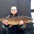
Guys slim creek on burntside is the place to load up on smelt -
By JerkinLips · Posted
My 3rd guess was finally correct. Definitely a moving target this year. Guess Date Ice Out 2/28 3/27 3/12 4/7 4/9 4/13 -
By Kettle · Posted
I have a few days off so hopefully fish 4 days in a row from sunrise to sunset. Likely two or three lakes a day depending on the bite. I won't fish any well known opener lakes until the weekday. -
By smurfy · Posted
i'm into them slimers.........dem make good picklin and smoker material......i'll chase some crappies too!!!!!! -

By leech~~ · Posted
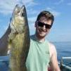
I usually only catch small slimers on opener until first part of June before the eyes really start, on my lake there. -
By smurfy · Posted
yes sir!!!!!!!!! by then most the riff raff is at home!!!!!! -
-
By smurfy · Posted
is 3 weeks away............who's going and where???? i skip the first week and i'll head up to the cabin the 2nd week. ussually fish smaller lakes.
-
Recommended Posts